Google Maps has always been great for getting from point A to point B, but not everything we do is quite so simple.
Google Maps Hack: Create a Whole New Route With This Trick

Google Maps has always been great for getting from point A to point B, but not everything we do is quite so simple. What if you don’t have an exact address for where you’re headed? Or want to find out where a three mile run from your house could take you? What if where we’re going we don’t need roads?
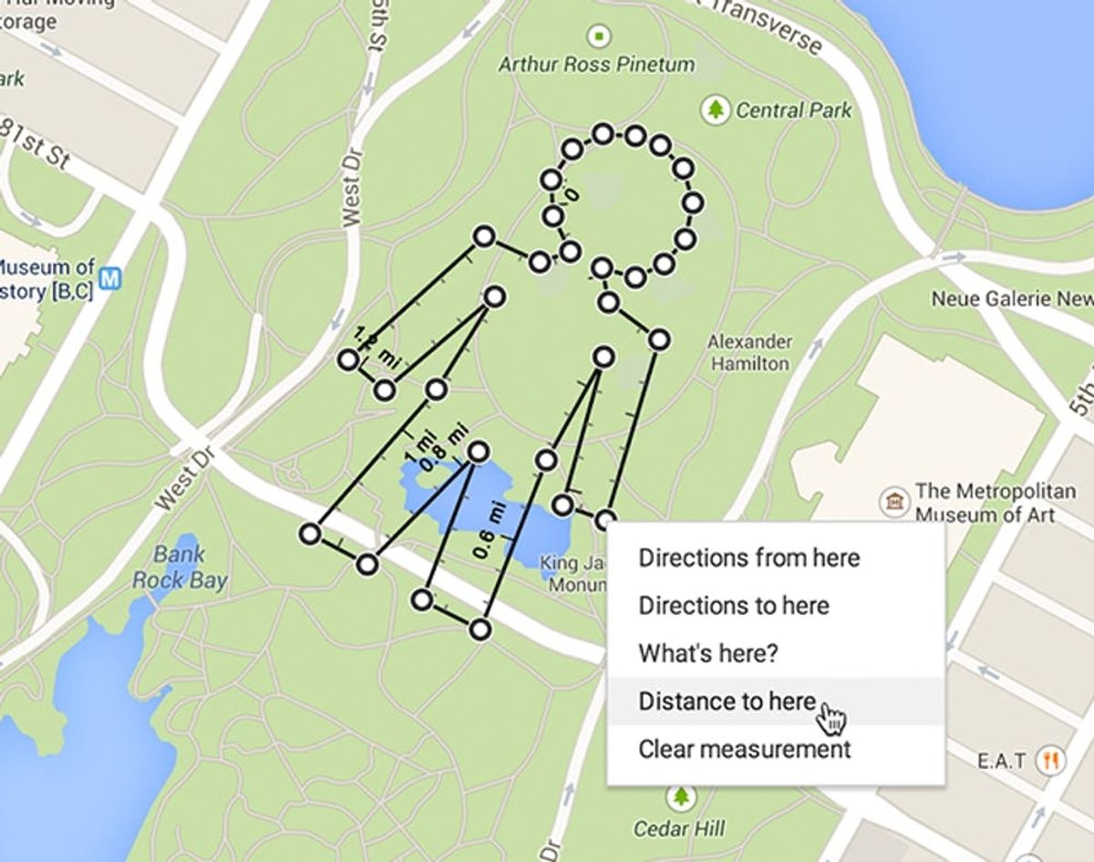
There’s a great new feature from Google Labs that allows you to measure distance between any points on a Google Map. Just right-click (or control-click) wherever you’d like to start, select “measure distance,” and then right-click a second location and select “distance to here.” Ta-da! A line appears with the measurement. Want to go farther? Click again to add to your route or drag lines to change it. Before this update, you had to type in a starting point and end point just to find the distance. Now with a couple of clicks, you’re good to go.
As Google Maps continues to expand to include more off-roading locations, like indoor spaces, trails, bike paths, public transit, street art hotspots (the list goes on!), it’s great not to be limited to roads when it comes to route planning. You can discover the distance of a walk through the park, an airport run or your flux-capacitor-aided Delorean’s flight through the sky. This would also be super helpful for weekend adventures, like planning a bike ride when you know how far you want to go but don’t have a particular destination in mind, or for hiking to a location without an address. If you know about how many miles per day you want to travel on your next epic journey, you could see where you’d end up each day.
An added bonus is that you can draw pictures with your distance-measuring lines, which is more just for fun than for actual navigation. Of course, you could plan an anniversary stroll in the shape of a heart, make an XO marks the spot to your wedding venue or take a friend on a scenic bday tour in the shape of their initial.
This deceptively simple feature adds a lot of functionality to what was already a stellar product. So far, it only seems to be available for desktop. We can’t wait to see a mobile version that lets you draw your route on the go!
How would you use this new Google Maps feature? Comment and let us know!
(h/t Tech Crunch; final image via Google)


