Some kind souls out there have devised the optimal maps for escaping the rise of the living dead.
These Zombie Maps Could Save Your Life During the Apocalypse

Our cute zombie dress-up ideas may be all fun and games for now. But once the zombie apocalypse actually comes crashing down on us, looking cute and spooky might not be enough to save your life (though it could make a worthy disguise). Lucky for all of us, some kind souls out there have devised the optimal maps for escaping the rise of the living dead.
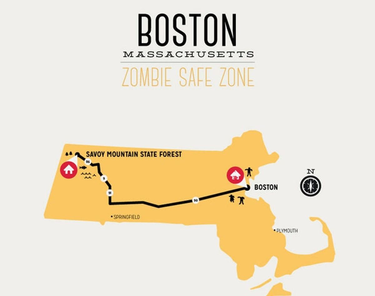
This collection of Zombie Safe Zone Maps is currently available in an impressive array of cosmopolitan hubs. We’re talking everywhere from San Francisco to Sydney, Austin to Boston, Columbus to Copenhagen (let’s just say we hope you can swim for that one) and beyond. They map out the most direct route from city center — which everyone knows is where the infection will spread the fastest — to a secluded safe haven with plenty of natural resources and an abundance of shelter perfect for hiding from the undead.
Okay, so trick and treat alert, these maps are really a cheeky tip of the hat to state forests and natural parks around the world. The “escape routes” are the quickest ways to the green pastures and idyllic scenery out of the hubbub of a city, which, when you’ve had enough of the concrete jungle, really does feel like an emergency escape route to a little slice of sanity.
And hey, whether you use these posters to decorate for your Halloween party or keep them on your walls for a cheeky nature-appreciating piece of art, at least you know that if the zombies do rise, you’ve got your plan all mapped out and ready to go. Major bonus: they’re each under $20 buckaroos.
Would you purchase one of these maps for your wall/escape plan? Let us know in the comments below!
(h/t Fast CoDesign)


